The implementation of the United Nations General Assembly resolution A/RES/80/307, “Correct the Map,” presents an opportunity for African countries to advance geographical accuracy, strengthen educational cooperation and promote a more informed understanding of the continent’s place in the international system. For Uganda, the initiative resonates with its commitment to African solidarity, effective multilateralism and a global order in which Africa’s realities, interests and contributions are accurately represented.
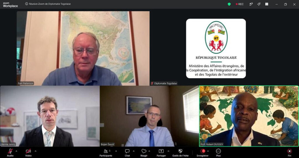
Adopted on 4 September 2026 with 164 votes, the resolution has gained momentum following a commitment by Tom Patterson, Bernhard Jenny and Bojan Šavrič, the designers of the Equal Earth projection, to provide scientific and technical support for its implementation. The commitment was announced during a virtual meeting on 20 September 2026, convened by H.E. Professor Robert Dussey, Togo’s Minister for Foreign Affairs, who championed the resolution on behalf of the African Union (AU). The Equal Earth projection, developed in 2018, represents the relative areas of the world’s landmasses more accurately than projections that substantially enlarge territories at higher latitudes.
For Uganda, the significance extends beyond cartographic presentation, Maps are widely used in education, public communication, research and international engagement, influencing how people understand geographical relationships and the relative scale of territories. Promoting appropriate map projections is therefore part of strengthening geographical literacy and ensuring that information presented to the public reflects the intended geographical reality.
Uganda’s diplomatic engagement with African institutions and the United Nations provides a platform for supporting initiatives that combine technical evidence, international cooperation and African priorities. The Correct the Map resolution demonstrates how collective diplomacy can elevate a specialised scientific issue into a subject of global discussion and institutional action.
The implementation discussions identified three priority areas: technical support for States and institutions adopting equal-area projections, freely usable reference maps, and educational resources for African school systems. These priorities offer practical opportunities for Uganda to consider the use of appropriate map projections in geography education, curriculum resources and public information materials. Collaboration among relevant government institutions, education authorities, academic bodies and development partners could help strengthen geographical literacy and encourage the responsible use of cartographic information. The proposed establishment of a scientific advisory group, to be advanced through a concept note by Togo, could further support technical coordination and knowledge-sharing. The participation of the Equal Earth designers in their personal capacities would help maintain a scientific basis for implementation.
Uganda’s interest in the initiative aligns with broader African efforts to strengthen continental cooperation through the AU and advance African priorities in multilateral forums. Supporting accurate geographical representation can complement the continent’s wider engagement on education, development and the communication of its economic, cultural and geographical diversity. The resolution does not change national borders or the physical size of continents. Rather, it encourages the use of equal-area projections when communicating relative territorial size, recognising that different map projections serve different purposes.
As implementation progresses, the priority will be to translate international commitments into accessible educational resources, informed institutional practice and sustained technical cooperation. For Uganda, this is an opportunity to support an African-led initiative grounded in scientific expertise and multilateral consensus reinforcing the principle that effective diplomacy is measured not only by resolutions adopted, but also by their practical contribution to public understanding and shared development.